
SV300
Autonomous unmanned surface vessel with GNSS RTK and 4G control
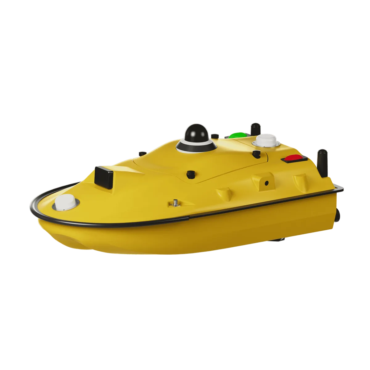
Limited record: this part has neither specifications nor a datasheet in the catalog yet. It is shown for reference and is not indexed.
Autonomous unmanned surface vessel with GNSS RTK and 4G control
The ComNav SV300 is an autonomous unmanned surface vessel (USV) for hydrographic surveys, with integrated GNSS RTK positioning and a payload capacity of up to 35 kg.
Overview. The ComNav SV300 is an autonomous unmanned surface vessel, reference SV300, designed for hydrographic surveys and automatic collection of underwater data. It integrates a high-precision GNSS positioning system, a depth sounder and vessel control software in a highly integrated main control design.
Main characteristics. Fully curved M-shaped monohull in high-molecular carbon fiber and Kevlar fabric, hull dimensions 980 × 520 × 254 mm, weight of 7 kg empty and 30 kg loaded including base station, controller and batteries. Navigation speed of 7 m/s, maximum payload of 35 kg, brushless DC motor rated at 900 W.
Positioning and navigation. DGNSS positioning accuracy of 40 cm + 1 ppm horizontal, RTK positioning accuracy of ±8 mm + 1 ppm horizontal, heading accuracy of ±0.1°, IMU update rate of 200 Hz. Compatible with GPS, BDS, GLONASS, Galileo, QZSS and SBAS, with support for CORS correction sources and the TT450 radio differential protocol.
Connectivity and interfaces. Two RJ45 Ethernet ports, two RS232 serial ports and two RS485 serial ports, data communication via 4G, 2.4G and optional radio, effective communication range up to 3 km with 4G remote control support.
Power and environment. Two 33.6 V 25 Ah lithium batteries, battery capacity of 20,000 mAh, 18 W fast charging through a standard Type-C port, power supply from 9 V to 28 V. Endurance of 3 h at 2 m/s or 7 h at 1.5 m/s on one battery pack, and an economical cruise range of 38 km. IP67 waterproof and dustproof rating.
Typical uses. Bathymetric surveys, seabed mapping, water quality analysis and detection of specific targets, thanks to compatibility with side-scan sonar, echo sounders, water quality sensors and automatic water samplers, and an open SDK for secondary development.
Safety. Automatic obstacle avoidance, 360° panoramic camera, forward field of view of ±120° with detection range of 0.1 to 20 m, automatic return in shallow water, dual redundant anti-collision design.
No published question about this part yet. Questions are reviewed before publication.
Official documents and the technical data recorded for SV300. For a missing document or a specific revision, our experts send it to you.
The ComNav SV300 is an autonomous unmanned surface vessel (USV) for hydrographic surveys, with integrated GNSS RTK positioning and a payload capacity of up to 35 kg.
Similar parts to answer your needs. Compare the main characteristics. A recorded replacement is a documented relation; a similar product is a similarity only, never a compatibility claim.
Autonomous unmanned surface vessel with GNSS RTK and 4G control
Kerui Wireless Plug Sound And Light Home Security Siren Alarm For Burglary

8-Lamp Flashing Alarm

ALM-Horn

Describe your application and constraints in a request.
What is recorded about the regulatory status and the life of this part.
No compliance statement is recorded for this part. Ask the supplier for the RoHS and REACH declarations and, for a radio product, the EU declaration of conformity.
| Current status | Status not stated |
| Key dates | Not recorded |
| Manufacturer part number | SV300 |
| Manufacturer | ComNav |
Alarm Sirens and Sounders
Smart home security starter kit with sensors and siren · Ref. : DCH-107KT
Price on request
Alarm Sirens and Sounders
Zigbee alarm siren for smart home and building security · Ref. : SIR216
Price on request
Alarm Sirens and Sounders
Wireless alarm siren with ultra-bright LED · Ref. : ISOS-ALM-HORN
Price on request
Alarm Sirens and Sounders
Wireless Outdoor Indoor Strobe Siren with Red LED
Price on request
No advertising or analytics cookies. A single, strictly necessary cookie is set only if you sign in to your account. Your quote basket and comparison stay in your browser. Details


